Issue 16
Issue 16
240128080616.png)
he formation of Ear per rone Age centres in pesopotamia is the resut of ong term processes hich can be e pained b en ironmenta economica and socia de eopments heir phsica appearance is not on a testimon of centrai ation but aso of the socia eoution relected in its impact on andscapes Large te sites surrounded b a eb of roads for inter-regiona and inter-site communication traceabe through aeria and sate ite photograph ofer a testing ground for ne methods hie the pains of northern S ria ha e itte ariation in terrain the centra Trans‐Tigris area sho s a high diferentiated terrain afected b the ridges of the agros iedmont one
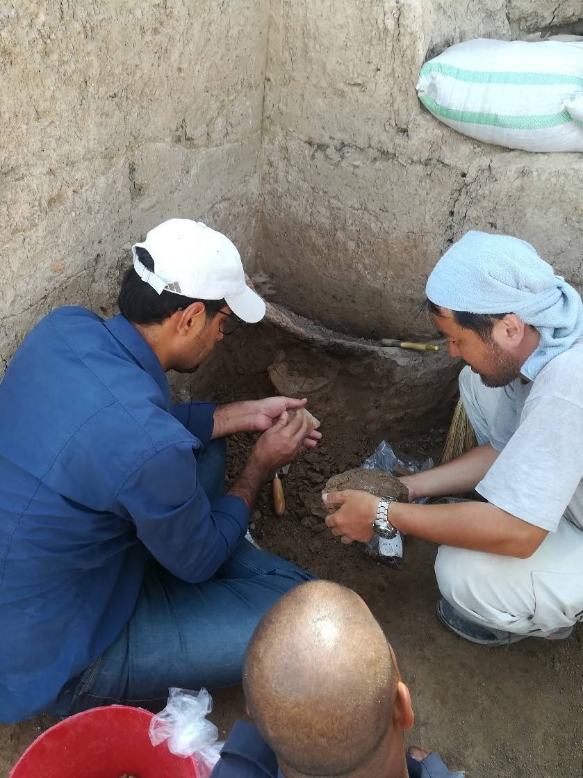
Grdi-Shakar Tapa on the Sharazor plain in Iraq's Kurdistan Region has revealed a new episode of the Neolithic discovery Shakar Tapa has been known as a conspicuous archaeological site in the south of the Shahrazor Plain since the mid-20th century. It has an oval plan consisting of a low northeastern mound and a high conical southwestern mound with a flat top. The Darband-i Khan Dam Lake is adjacent to the north of the site and its water occasionally reaches the skirt of the mound, causing crucial erosion of the northern edge of the mound. Many archaeological materials were collected on the surface of Shakar Tapa in the past. Although most of them can be dated to the historical ages, such as the Early-to-Middle Bronze Age, the Iron Age, and the Parthian-Sasanian Period, some artefacts were certainly dated to the prehistoric period. In 2019 a Japanese archaeological team (directed by Takahiro Odaka, Kanazawa University) started the excavations of Shakar Tapa to investigate its late prehistoric occupation. The first operation of a step trench was set at the northwestern skirt of the high mound and yielded the Ubaid deposit and the Late Neolithic stratigraphic sequence covering ca. 6400-6000 BC. Virgin soil was reached at the northwestern end of the trench about 5 m below the highest level of this trench. The second season carried out in 2023 revealed the younger Late Chalcolithic deposit at the area near the trench in 2019. In addition, a few low satellite mounds were identified west of the main mound and another late prehistoric deposit was uncovered at one of them.
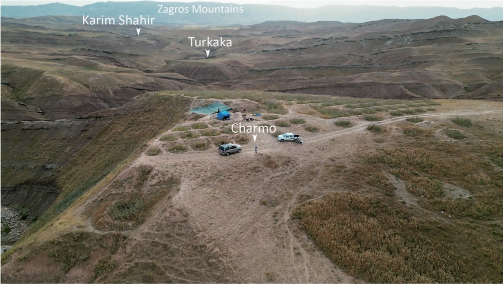
The archaeological mission from the University of Tsukuba began to investigate the Neolithic sites in the Iraqi-Kurdistan region in 2014. The purpose of our investigations was to reconsider the issue of Neolithization in Iraqi-Kurdistan, where research began in the 1940s and 50s and was stalled by political issues starting in the 1960s. With the full support of the Directorate General of Cultural Heritage of the Ministry of Culture of the Kurdistan Regional Government and the Slemani Department of Cultural Heritage, we first began our research at the Qalat Said Ahmadan site, located in the Pshdar Plain. We were able to identify the cultural deposits of the end of the Pre-Pottery Neolithic period, those of the Hassuna, Samarra, Halaf, Ubaid, and Iron Age, and have clarified the nature of the Neolithic site located at the edge of the fan deposits [Tsuneki et al. 2015, 2016, 2019].
Issue 16