240111034030.jpg)
240128075940.png)
Complex local settlement in Zagros Mountains before the Assyrians expanded into this region
The Dinka Settlement Complex now provides important evidence that a large and complex local settlement with social stratification and a central administration existed in the Zagros Mountains before the Assyrians expanded into this region
About 5 km south of the district town of Qaladze, in the Peshdar Plain on the eastern bank of the Little Zab, lie the two archaeological sites of Qalat-i Dinka and Gird-i Bazar. Archaeological field research conducted by the German universities LMU Munich (Prof. Karen Radner) and WWU Münster (Prof. Janoscha Kreppner) together with the directorates of antiquities Sulaymaniyah and Raparin have shown that people lived at these sites for several millennia, )Qalat-i Dinka and Gird-i Bazar in the Peshdar Plain(.
The oldest traces date back to about 5000 BCE and extend through the Bronze and Iron Ages to modern times. According to the results of geophysical prospecting, excavations and 14C dating, a large settlement existed in the Iron Age, reaching an extent of 60 ha in its main occupation phase about 1050 to 800 BCE, much larger and more complex than what would have been expected in the region from previous knowledge.
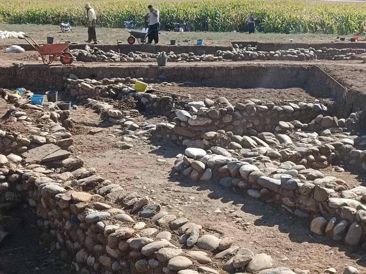
Since we do not know the ancient name of the site, we call it the Dinka Settlement Complex. The settlement was divided into different functional areas: a fortress with elites in the upper town on the western slope of Qalat-i Dinka, and residential and ceramic workshop areas to the east of the lower town in Gird-i Bazar. Set somewhat apart from the residential areas by an open space, an administrative centre consisting of the three Buildings K, L and M is located in the north of the lower town.
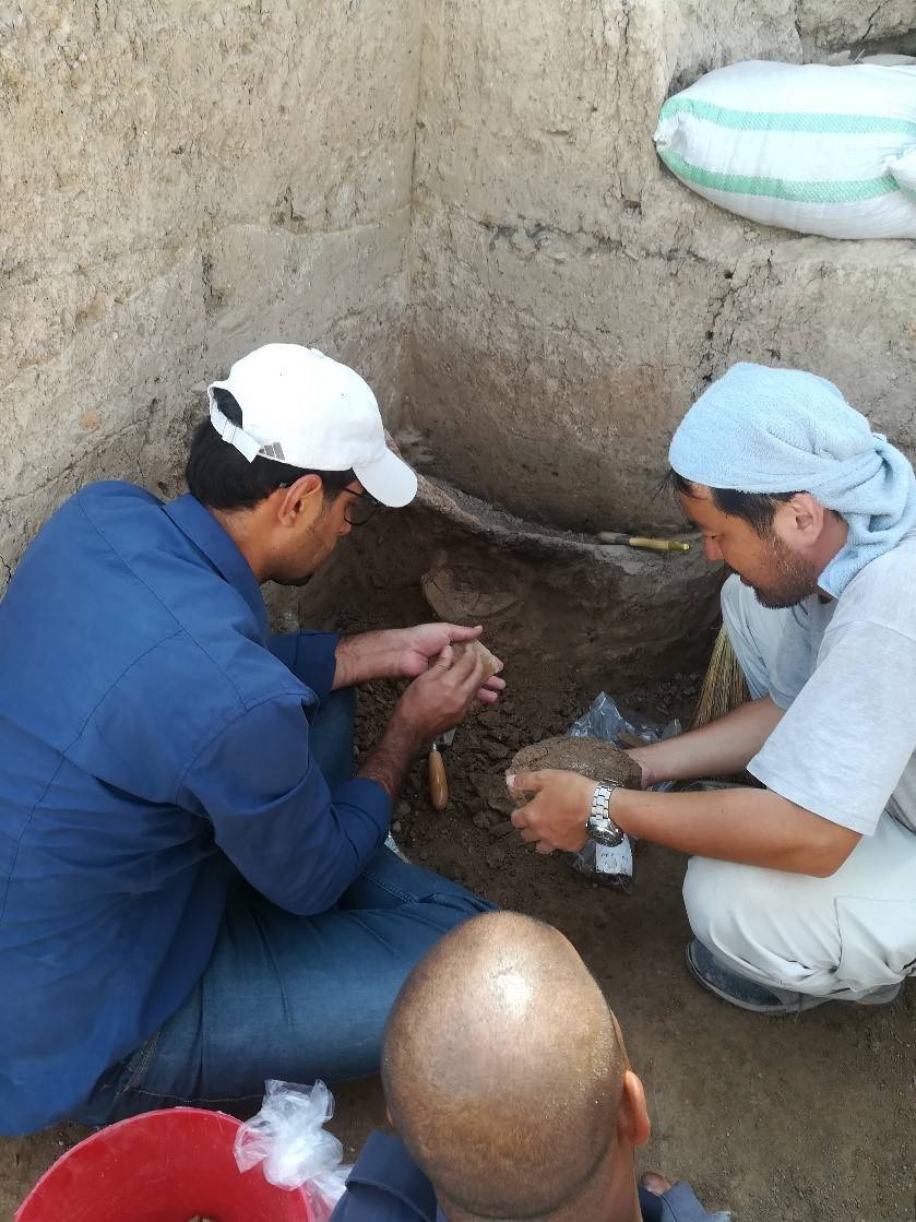
Building L, which is about 700 square meters in size, has been particularly well planned. A central courtyard is flanked on each of its four sides by a row of rooms. Two rooms in the north of the building stand out: Room 37 is characterised by its size of about 60 square metres. The room is accessible from the courtyard via a threshold of fired brick and has a pedestal-like elevation at its north-eastern end. A white lime plaster floor was used only in this room and is well preserved in places. On the pedestal, next to the entrance, was a large ceramic vessel from which water could be offered to guests. This room can be interpreted as a representative reception room because of these features. Room 35 is 48 square metres in size. Along the walls were clay benches on which large storage vessels had once been placed, but these were found broken into thousands of shards 13 large storage vessels could be reconstructed from the shards. From the bottom of one of these vessels from the northern corner of the room came two charred seeds of emmer (Triticum dicoccum), which we also used as samples for radiocarbon dating (1012-894 calBCE and 930-824 calBCE). Accordingly, large quantities of grain were stored in Room 35 for the community.
From about the middle of the 9th century BCE, the settlement under study was situated on the eastern border of the Assyrian Empire, whose heartland lay in the Mesopotamian lowlands in the area of the present-day cities of Mosul and Erbil. Thus, the Dinka Settlement Complex was located on the periphery from the Assyrian point of view. Since indigenous written sources from the mountainous region are lacking, our information about the Zagros Mountain people comes mainly from Assyrian written sources. However, these take the perspective of the Assyrian ruling elite with its political, economic and strategic interests, which is why information about the Zagros inhabitants in Assyrian texts is not necessarily truthful and they are portrayed as enemies.
With the excavation results, archaeological data stored in the ground can now be juxtaposed with Assyrian written sources, enabling a reassessment of the social organization of Iron Age societies in the Peshdar Plain.
The excavations at Qalat-i Dinka and Gird-i Bazar will contribute to highlighting the importance of the local in the Zagros Mountains, in so-called peripheries, borderlands, and areas outside the Assyrian-controlled sphere of influence, and to better understanding local phenomena in interaction with the Assyrian centres. The Dinka Settlement Complex now provides important evidence that a large and complex local settlement with social stratification and a central administration existed in the Zagros Mountains before the Assyrians expanded into this region. The Dinka Settlement Complex functioned as a local centre in a region with high resource availability and convenient location on transportation routes that connected the Mesopotamian lowlands with the Iranian highlands.
