language
En Ku Ar

Image Title calendar2024-02-28

Opening a scientific course for training and teaching in photogrammetry program

Training course on photogrammetry program was held from 18/2/2024 to 23/2/2024 in Slemani. The course was taught by archaeologist Tiago Costa for a few days

Image Title calendar2024-01-29

Excavations at Shaikh Marif, Iraqi Kurdistan Preliminary Report of the First Season (2022)

Grdi-Shaikh Marif The archaeological site of Shaikh Marif, located in the Shahrizor Plain ca. 500 m south of Gird Shamlu along the Wadi Shamlu, was registered by the Iraq Museum in 1943. In November 2012, the Shahrizor Survey Project additionally identified several new artificial mounds near Shaikh Marif. Among them, a cluster of two tiny mounds is called, together with Shaikh Marif itself, “Se Tapanسێ تەپان ” by the local people, and thus all three mounds were designated “Shaikh Marif”: Shaikh Marif I (the original northern mound), Shaikh Marif II (a western mound also called “Ash Shaikh Marif” by the locals), and Shaikh Marif III (an eastern mound). The land is seasonally cultivated today, and the water of the Darband-i Khan Dam Lake occasionally covers almost entire areas of the mounds. Owing to modern cultivation and the erosion by flowing water, a large amount of archaeological materials were easily observed on the surface. While no prehistoric material was identified at Shaikh Marif III, numerous Late Neolithic potsherds were scattered across the other two mounds as well as the materials dated to the younger periods. The date of these Late Neolithic sherds was estimated to be ca. 6400 6000 BC. A Japanese archaeological team (directed by Takahiro Odaka, Kanazawa University) excavated Shaikh Marif II in 2022 and revealed the Late Neolithic layers, which directly accumulated on the virgin soil. Most of the finds were dated to ca. 6100-6000 BC, although a small amount of the artefacts from the historical periods indicate human activities in the middle Medieval and the Ottoman Periods.

Image Title calendar2024-01-11

The Last Hunters of the Eastern Fertile Crescent Archaeological Project

Ashkawta Rash(ئەشکەوتە ڕەش) is a Palaeolithic cave site located. 35 km northwest of the city of Slemani, near the Bazian Gates.

Memorandum of Understanding Between Slemani antiquities and heritage Directorate and Kurdistan Geological Society Slemani Branch

Article Name

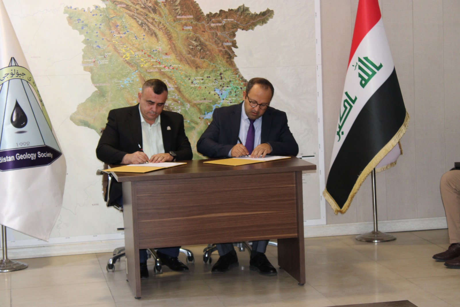
Slemani antiquties and heritage Directorate  signed a memorandum of understanding between our directorate as a government entity and Kurdistan Geologists Association Slemani Branch to further coordinate and serve these two fields in Kurdistan in general and Sulaimani in particular.
 The memorandum of understanding is for the opening of joint courses and participation of cadres of both sides in such courses that are necessary and important for archaeological and geological affairs in both sides. 
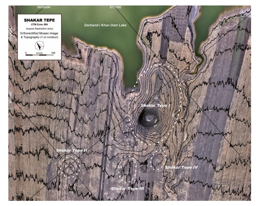
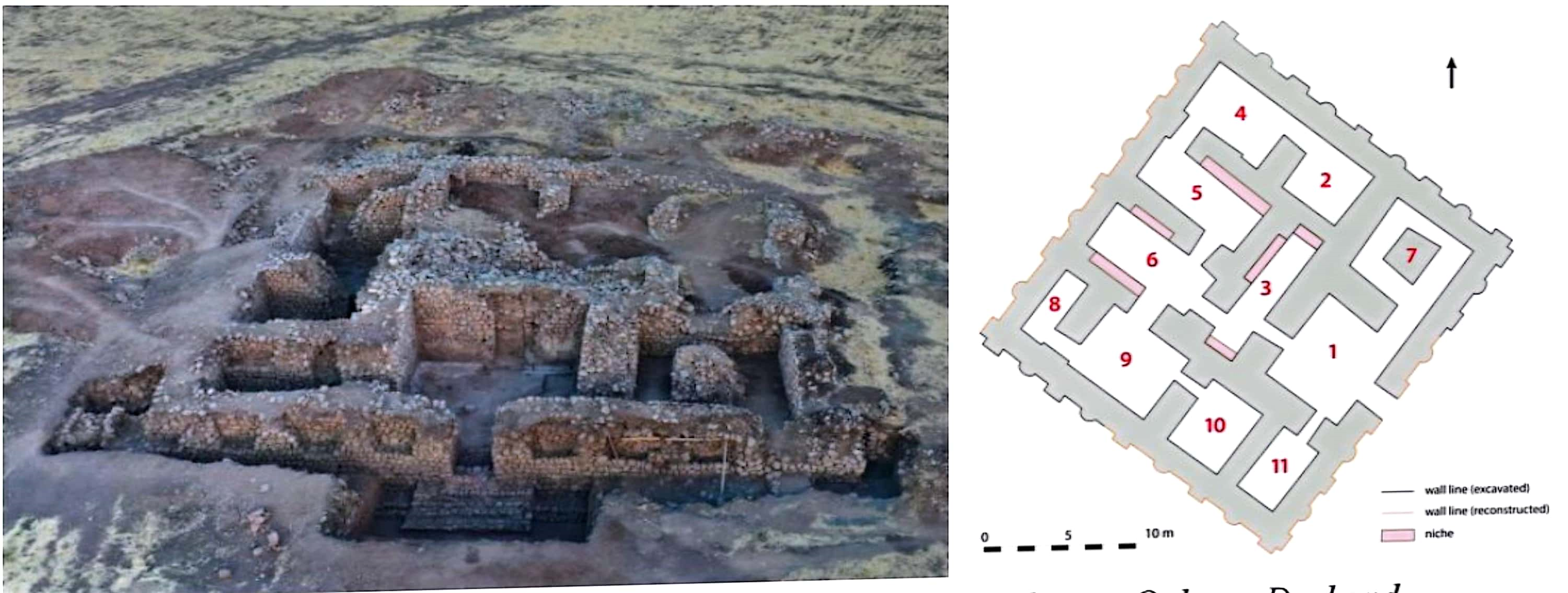
 The new vision of archeology is to combine a number of important sciences, above all geology, which is considered to complement the stages of archaeological work. We have dozens of important archaeological and geological sites in Slemani province.