Issue 14
Issue 14

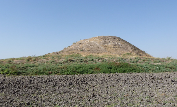
The site is one of the largest tell-type sites in the Slemani Governorate and contains rich archaeological remains from the Neolithic to the Islamic periods.
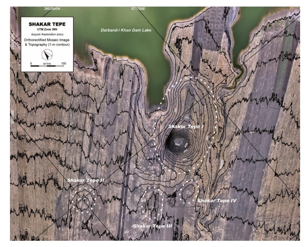
The Shahrizor Plain is one of the ideal fields for tracking the transition from Neolithic village life in the Fertile Crescent to Urbanisation which occurred in Mesopotamia because of its geographical location connecting the mountainside valleys along the Zagros and the downstream Diyala River that flows into the Tigris. Our field project aims to obtain archaeological materials to unveil this process. Following the first excavations at Shakar Tepe conducted in 2019, we excavated two additional areas at this site in 2023, including one of the three satellite mounds that were newly identified around the main mound. The cultural remains of the Late Halaf settlement uncovered from Operation B at Shakar Tepe II date back to approximately 5600–5400 calBC. On the other hand, Operation C at Shakar Tepe I yielded a thick deposit of the Late Chalcolithic occupations dated to ca. 3800–3600 calBC. The recovered materials fill the time ranges in the late prehistoric chronology of the site and will contribute to our understanding of the historical role of this region in the transition from Neolithisation to Urbanisation.
The site of Gird-î Qalrakh is a small but steep settlement place in the North-eastern Shahrazor-Plain. It was excavated in three seasons (2016, 2017 and 2019), the fourth season 2023 has just started. The archaeological discovery will be carried out jointly by the Slemani Archaeological and Heritage Directorates, along with two universities (University of Erlangen and University of Frankfurt), in Gridi-Kazhaw and Qalrgh. It will continue for years.
Issue 14