Issue 20
Issue 20
Shakar Tapa has been known as a conspicuous archaeological site in the south of the Shahrazor Plain since the mid-20th century. It has an oval plan consisting of a low northeastern mound and a high conical southwestern mound with a flat top.
240128080157.png)
Archaeological features, such as architecture etc. can be traced by high resolution and large-scale magnetometer prospecting. Moreover, soil magnetic data deliver additional information about the alteration of the ancient landscape. In combination with an archaeological survey, the geophysical results can provide information to reconstruct the spatial organization within these settlements as well as an epoch-spanning analysis of settlements and their role in urbanization processes and within settlement hierarchies.
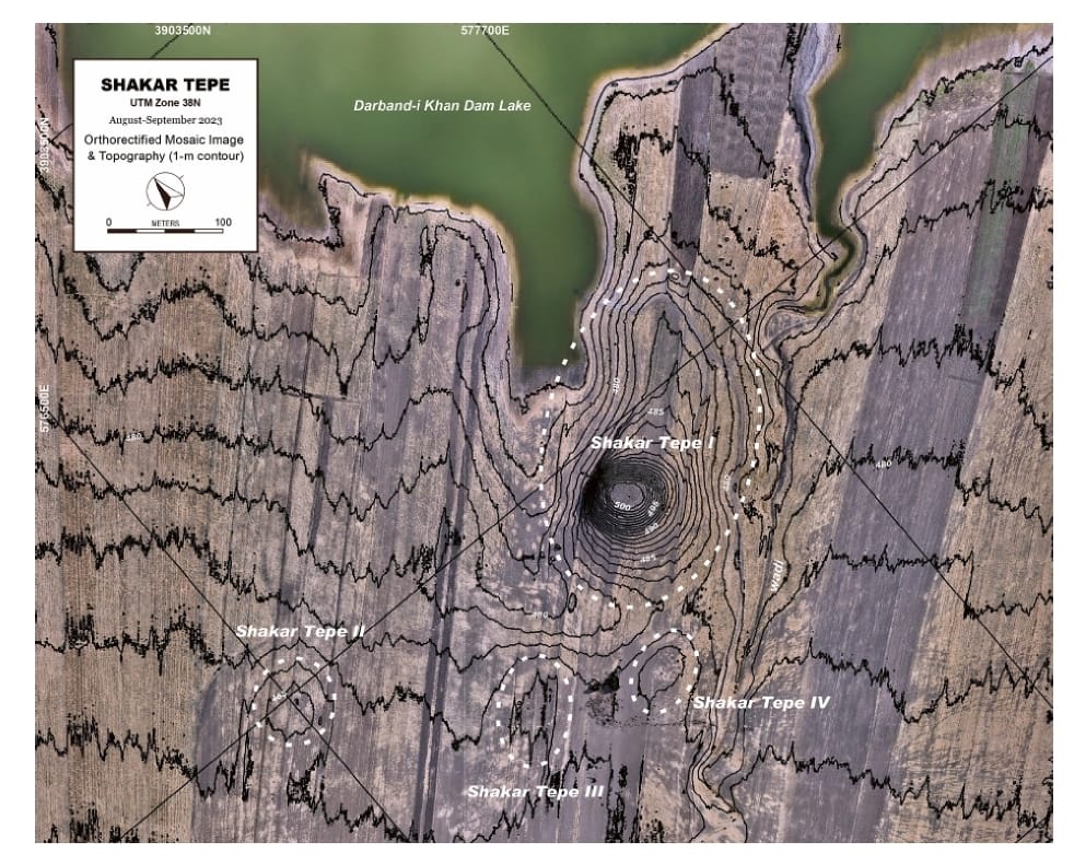
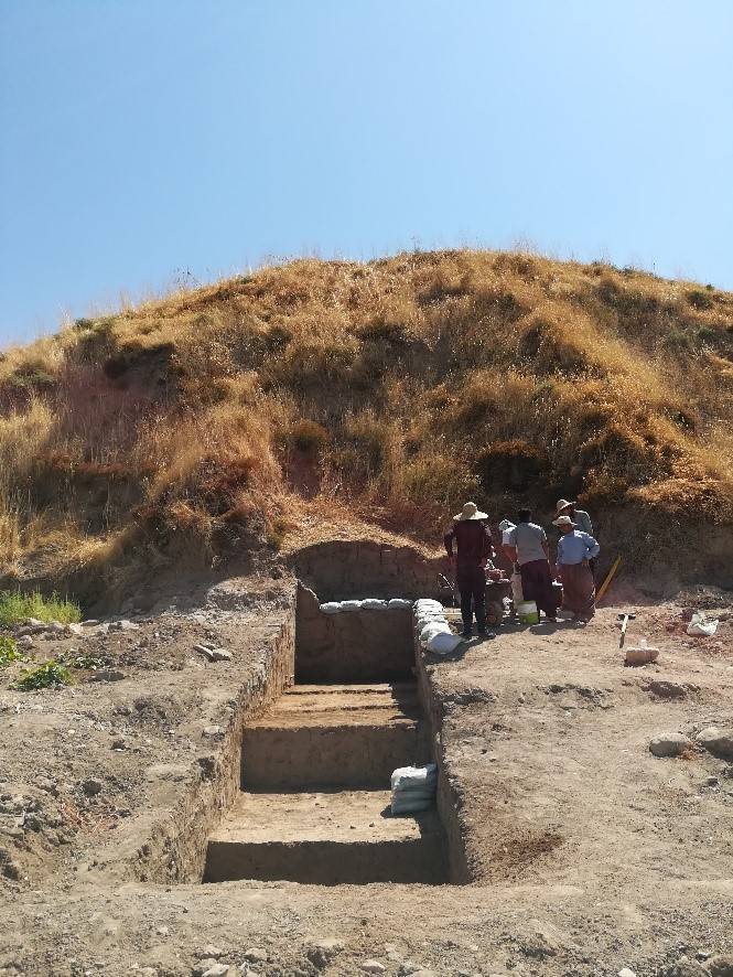
The Shahrizor Plain is one of the ideal fields for tracking the transition from Neolithic village life in the Fertile Crescent to Urbanisation which occurred in Mesopotamia because of its geographical location connecting the mountainside valleys along the Zagros and the downstream Diyala River that flows into the Tigris. Our field project aims to obtain archaeological materials to unveil this process. Following the first excavations at Shakar Tepe conducted in 2019, we excavated two additional areas at this site in 2023, including one of the three satellite mounds that were newly identified around the main mound. The cultural remains of the Late Halaf settlement uncovered from Operation B at Shakar Tepe II date back to approximately 5600–5400 calBC. On the other hand, Operation C at Shakar Tepe I yielded a thick deposit of the Late Chalcolithic occupations dated to ca. 3800–3600 calBC. The recovered materials fill the time ranges in the late prehistoric chronology of the site and will contribute to our understanding of the historical role of this region in the transition from Neolithisation to Urbanisation.
Issue 20