language
En Ku Ar

Image Title calendar2024-07-25

Memorandum of Understanding Between Slemani antiquities and heritage Directorate and Kurdistan Geological Society Slemani Branch

Slemani antiquties and heritage Directorate signed a memorandum of understanding between our directorate as a government entity and Kurdistan Geologists Association Slemani Branch to further coordinate and serve these two fields in Kurdistan in general and Sulaimani in particular.

Image Title calendar2024-01-28

Complex local settlement in Zagros Mountains before the Assyrians expanded into this region

About 5 km south of the district town of Qaladze, in the Peshdar Plain on the eastern bank of the Little Zab, lie the two archaeological sites of Qalat-i Dinka and Gird-i Bazar.

Image Title calendar2025-01-17

Halaf and Late Chalcolithic occupations at Shakar Tepe in the Shahrizor Plain, Iraqi Kurdistan: Preliminary report of the 2023 excavations

The Shahrizor Plain is one of the ideal fields for tracking the transition from Neolithic village life in the Fertile Crescent to Urbanisation which occurred in Mesopotamia because of its geographical location connecting the mountainside valleys along the Zagros and the downstream Diyala River that flows into the Tigris. Our field project aims to obtain archaeological materials to unveil this process. Following the first excavations at Shakar Tepe conducted in 2019, we excavated two additional areas at this site in 2023, including one of the three satellite mounds that were newly identified around the main mound. The cultural remains of the Late Halaf settlement uncovered from Operation B at Shakar Tepe II date back to approximately 5600–5400 calBC. On the other hand, Operation C at Shakar Tepe I yielded a thick deposit of the Late Chalcolithic occupations dated to ca. 3800–3600 calBC. The recovered materials fill the time ranges in the late prehistoric chronology of the site and will contribute to our understanding of the historical role of this region in the transition from Neolithisation to Urbanisation.

Archäologisch-geophysikalische Prospektion am Rande des Zagrosgebirges in Kurdistan

Article Name

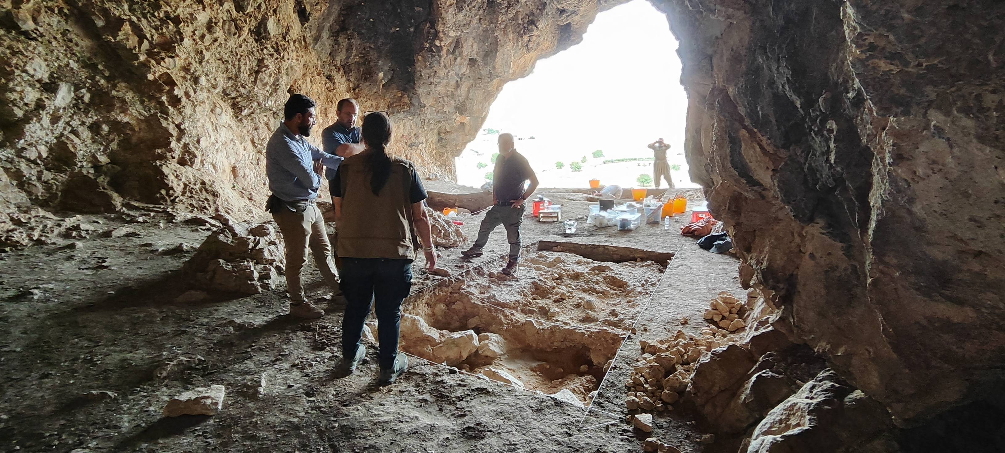
Im Rahmen eines Forschungsprojektes begab sich ein bayerisches Prospekti onsteam im Oktober des vergangenen Jahres auf eine Forschungsexpedition in den Nordostirak, enauer in die süd kurdischen Provinzen Sulaymaniyah und Halabjah. Hier in der Shahrizor Ebene, nahe der irakisch-iranischen Grenze, sollten an drei Fundorten Un
tersuchungen durchgeführt werden. 

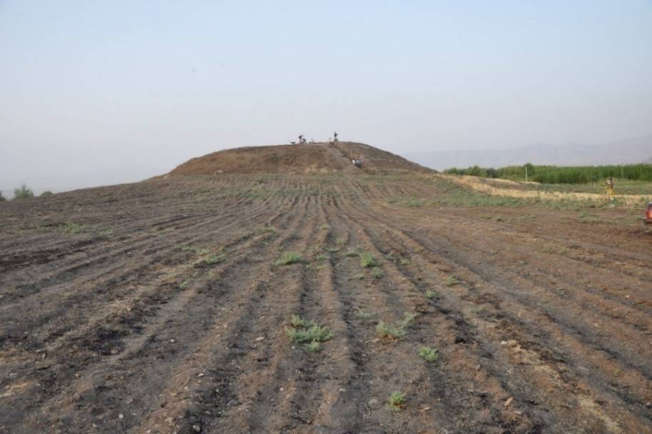
Das Projekt fand in Kooperation zwischen dem Antikendienst Sulaymani yah, dem Bayerischen Landesamt für Denkmalpl ege sowie den Instituten für Vorderasiatische Archäologie und dem Department für Geowissenschaften der Ludwig-Maximilians Universität München stat . Bereits im Jahre 2000/01 konnten Mitarbeiter dieses Teams im Süden des Landes große Bereiche der legendären Stadt Uruk vermessen – mit spektakulären Forschungsergebnissen (DI 122, 2002). Auch hier war es Ziel gewesen, die Möglichkeiten der Pros pektionstechniken auf mehrphasigen Siedlungshügeln, also im schwierigen Gelände, durch Magnetometer-Messun gen zu erproben, weiterzuentwickeln und anhand dieser Messungen archäo logische Pläne zu erstellen.